Do go chasing waterfalls this summer. Discover eight hikes in New Hampshire with beautiful waterfalls, scenic views, and options for every skill level.
If you’re anything like me, you probably want to spend the summer around as much water as possible. And while beach days are totally awesome and hard to beat, don’t sleep on New Hampshire’s beautiful waterfall hikes. Personally, I love waterfall hikes because they’re the perfect combination of challenge and relaxation. You get to move your body, get your heart rate up, see beautiful things, and unwind by the water.
Here are eight of my favorite New Hampshire waterfall hikes, ranging in difficulty, length, and location.
Easy
Diana’s Baths
Distance: 1.1 miles
Elevation gain: 60 ft.
Location: Bartlett (near Intervale)
Short, sweet, and beautiful; those are just a few words to describe Diana’s Baths. This popular hike, located near Intervale, New Hampshire, is well-loved for a reason. From the start, you’ll find yourself meandering through a peaceful forest filled with tall trees and plenty of shade. And while the trail itself is lovely, the real star of the show is the destination: Diana’s Baths, a tranquil area with beautiful waterfalls and natural swimming holes. These cascading falls reach a total of 75 feet! It’s the perfect spot to enjoy lunch, take a swim, or just soak in the beauty of nature.
This trail can get fairly busy, especially by late morning. Luckily, there’s plenty of parking at the trailhead, along with restrooms and trash collection. please note that there is a small fee to park here.

Franconia Falls Trail
Distance: 7 miles out and back
Elevation gain: 440 ft
Location: Lincoln
If you’re looking for something a little longer than Diana’s Baths but still want to keep it chill, check out Franconia Falls Trail. With just under 500 feet of elevation gain, peaceful forest scenery, and a beautiful waterfall at the end, this hike is a great, low-key option. Along the way, you’ll pass through the woods, cross over bridges, and follow a wide, mostly flat trail. The first three miles follow an old railroad bed and are relatively flat. As you get closer to Franconia Falls, you’ll encounter a bit of elevation gain, but nothing too steep or challenging.
The trail is well-marked and very dog- and kid-friendly. Like many hikes in the area, it’s a popular spot, so plan to start early if you want to beat the crowds.
Mount Willard Trail
Distance: 3.1 out and back
Elevation gain: 900 ft.
Location: Saco Lake near Bretton Woods
Ready to push yourself just a little more? Or maybe you’re looking for the perfect introductory hike to the White Mountains. Mount Willard Trail is an excellent early-season option for exploring the area. This three-mile out-and-back route starts at Lake Saco and takes you on a relatively steep climb to the summit.
Along the way, you’ll encounter small water crossings (waterproof shoes recommended!), rocky terrain, and gorgeous forest views. Before reaching the top, you’ll pass a waterfall and centennial pool, which makes a great spot to pause and catch your breath before the final stretch. At the summit, your hard work is rewarded with panoramic views of the White Mountains, especially Crawford Notch and the surrounding range.
There’s an optional parking donation at the trailhead. Keep in mind that the trail can get buggy in the summer, especially at the top, so bring bug spray and dress accordingly!
Moderate
Arethusa Falls via Bemis Brook and Arethusa Falls Trails
Distance: 2.8 miles out and back
Elevation gain: 885 ft
Location: Harts Location
If one waterfall isn’t enough for you, head out to Arethusa Falls. This specific route gets you there via Bemis Brook and Arethusa Falls Trails. Not only will you get to experience the stunning Arethusa Falls, but you’ll also pass several smaller waterfalls along the Bemis Brook Trail.
This lollipop-style out-and-back trail begins on Arethusa Falls Road. From there, you can hop onto the Bemis Brook Trail, which is fairly steep, especially near the end before it reconnects with the main Arethusa Falls Trail. If you’d prefer a more gradual climb, you can skip Bemis Brook and start directly on the Arethusa Falls Trail instead.
Once you reach Arethusa Falls, take some time to soak in the peaceful atmosphere and admire one of New Hampshire’s tallest waterfalls before making your way back.
There is a $5 fee for parking, but the lot is large, making it easy to find a spot.

Basin Cascade Trail
Distance: 2.5 miles out and back
Elevation gain: 630 ft.
Location: Lincoln
Hike back in time on the Basin Cascade Trail. This route leads you to The Basin, a large glacial pothole measuring 30 feet in diameter and 15 feet deep, formed around 25,000 years ago. This popular wonder was famously described by writer and naturalist Henry David Thoreau as “perhaps the most remarkable curiosity of its kind in New England.”
The trail features a steady climb and takes you past Kinsman Falls on the way to The Basin. Note that there is a water crossing along the route, so proceed with caution depending on water levels. Waterproof shoes are highly recommended, and it’s a good idea to pack an extra pair of dry socks.
This is one of the best trails for spotting multiple waterfalls and deep pools, giving you the chance to take a mid-hike swim or dip your feet in the water. Once you reach The Basin, you’ll find picnic tables and plenty of space to relax, have lunch, and take in the beauty of this unique place.
Parking is free, and the lot is fairly large.

Difficult
Mount Lafayette and Franconia Ridge Trail Loop
Distance: 8.6-mile loop
Elevation gain: 3,815
Location: Franconia Notch State Park
Located just two hours outside of Boston, the Mount Lafayette and Franconia Ridge Trail Loop is undeniably one of the most beautiful and popular hikes in the White Mountains. On this 8.6-mile loop, you’ll summit three peaks: Little Haystack Mountain (4,740′), Mount Lincoln (5,089′), and Mount Lafayette (5,249′). With nearly 4,000 feet of elevation gain, this hike takes most people around 8 hours to complete.
You’ll start out on the Falling Waters Trail, where you’ll encounter a number of gorgeous waterfalls, including the impressive 80-foot Cloudland Falls. From there, the trail leads you up to the summit of Little Haystack. You’ll then follow the Franconia Ridge Trail, offering some of the most beautiful views of the region, before continuing on to the summits of Mount Lincoln and finally, Mount Lafayette, the tallest peak in New Hampshire outside of the Presidential Range.
While this trail is well worth the trek, it’s also demanding and potentially dangerous if you’re not adequately prepared. Weather conditions can change quickly, and you’ll be above treeline for over a mile, so be sure to check the forecast and bring appropriate gear.
There’s a large parking lot at the trailhead, but it fills up fast, especially on weekends. Fortunately, there’s an overflow lot with a shuttle service to and from the trailhead.
Mount Pierce via Crawford Path
Distance: 6 miles out and back
Elevation gain: 2,389 ft
Location: Bretton Woods
If you’re looking to see a waterfall, go for a swim, and conquer your first New Hampshire 4,000-footer, then Mount Pierce via Crawford Path is the hike for you. This 6-mile out-and-back trail follows a steady, gradual climb to the summit of Mount Pierce. Early on, you can take a short detour to visit Gibbs Falls, perfect for a quick swim or break, before continuing your trek upward for 360-degree views from the summit.
In addition to being a beautiful and rewarding hike, this trail holds a special place in history: the Crawford Path is the oldest continuously maintained hiking trail in the United States. It dates back to 1819 and has been in use for over 200 years.
The route is considered challenging due to its 2,389 feet of elevation gain over the three miles to the top. The terrain is rugged and exposed in parts, so proper footwear and preparation are essential.
The trailhead parking lot is fairly large, but it does fill up quickly. Parking is $5.
Mount Washington via Tuckerman Ravine and Lion Head Trail (plus some beginner options!)
Distance: 8.3 miles out and back
Elevation gain: 4,242 ft.
Location: Gorham
Want to say you’ve stood on the highest point in New Hampshire and summited the tallest peak in the White Mountains? Then set your sights on Mount Washington, which towers at 6,288 feet. One of the most popular ways to reach the summit is via the Tuckerman Ravine and Lion Head Trails.
But don’t let the word “popular” fool you; this is a very difficult hike. With over 4,000 feet of elevation gain and notoriously unpredictable weather, this route should only be attempted by experienced hikers on good weather days. Even in summer, snow and ice are common at higher elevations, so microspikes and multiple layers are essential. Always check the weather forecast before heading out, as Mount Washington has some of the most extreme conditions in the country.
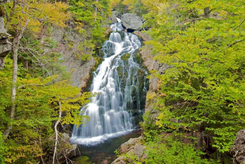
If you’re looking for a shorter adventure with waterfall views, without the intense climb, you’re still in luck. All of these routes begin at the Pinkham Notch Visitor Center. From there, beginners can take a short 0.3-mile hike to Crystal Cascades, a two-tiered waterfall with a total drop of over 90 feet.
If you’re up for a bit more distance but still not ready to summit, you can hike to Hermit Lake Shelters, about 2.4 miles in. Along the way, you’ll pass Crystal Cascades and eventually arrive at a scenic alpine zone with views of Tuckerman Ravine and another smaller waterfall near the shelters. It’s still a solid hike with a big reward and far less risk than going all the way to the top.
If summiting a mountain still has your interest, but you don’t want to miss the waterfalls, then you’re in luck—you’ll pass both Crystal Cascades and Hermit Lake on your way up. That’s two waterfalls and a summit, all in one hike, wow.