It may the middle of a hot July, but up in New Hampshire, the sun is nowhere to be found.
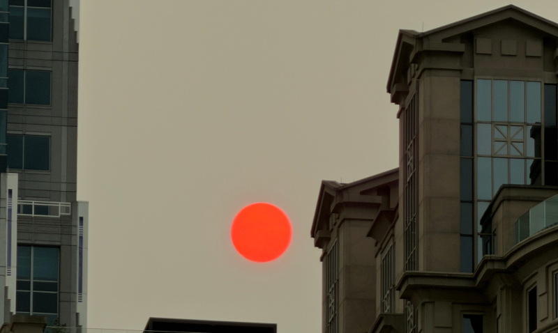
Thick smoke from Canadian wildfires is currently blowing through northern New England, clouding the New Hampshire skies with an orange-yellow haze. While the air quality remains safe in most of the state, the wildfire smoke is affecting the New Hampshire weather, with lower high temperatures and less storms than originally forecasted.
Here’s what to know about the wildfire smoke and its effects in New Hampshire.
When will the wildfire smoke move out of New Hampshire?
The National Weather Service (NWS) of Gray, Maine says that wildfire smoke is expected to linger over New Hampshire throughout Wednesday, July 15 and Thursday, July 16. Thick smoke and high clouds are dimming the sun this morning, likely limiting today’s high temperatures by a few degrees.
Smoke will likely be patchy tomorrow, July 16, with cold fronts moving in at the end of the day ahead of a cooling trend going into the weekend.
Is the air quality unsafe in New Hampshire?
According to the U.S. Air Quality Index map, air quality in most of New Hampshire is moderate, meaning only those who are unusually sensitive to particle pollution should reduce their outdoor activity.
However, a pocket of southern New Hampshire is seeing worse air quality than the rest of the state. The air quality in Cheshire, Hillsborough, southern Merrimack and southern Sullivan counties is unhealthy for sensitive groups, meaning those with heart or lung disease, older adults, children and teens should reduce their exposure to the outdoors.
Air quality is unhealthy in certain towns in Cheshire, Hillsborough and Merrimack counties, including Hillsborough, Bennington, Francestown, Peterborough and Jaffrey. Everyone in an area with unhealthy air quality should reduce the amount of time they are active outdoors.
You can check the air quality in your location by using the online map from the U.S. Air Quality Index.
Thunderstorms possible in New Hampshire
Cold fronts moving through New Hampshire pose threats of localized, strong afternoon thunderstorms today, July 15 and tomorrow, July 16, says the NWS. While widespread heavy rain is not forecasted, wind gusts are the primary hazard associated with these storms, with gusts up to 30-35 mph in parts of the state.
However, the NWS also explains that thick smoke may limit the chances of afternoon storms, just as it did on Tuesday, July 14.
This article originally appeared on Portsmouth Herald. Reporting by Catherine Messier.